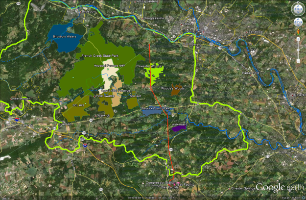
If you have Google Earth, you can click on this link and open the data in Google Earth. The map shows the location of the proposed pipeline relative to areas significant to the region. Once you open the file, zoom in for a more refined view, on the left-side check and un-check feature names to show or hide layers.
The Hopewell Big Woods delineates one of the most important areas in the state.
